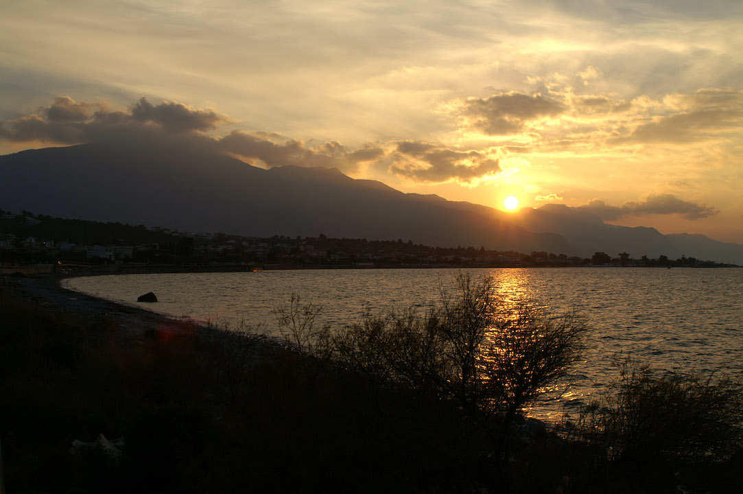
Alepchori
Just 20 km. from Megara and 60 km. from Athens, there is perhaps one of the most famous seaside resorts in western Attica, Alepohori. The site is located on the east side of the Corinthian Gulf, at the foot of Gerania Mountains. The beautiful beaches available, occupy several kilometers with alternating landscapes, since the area has sandy and rocky beaches, secular or not, but also beaches full of pine trees which are accessed only by boat.The settlement is continuously growing since the early 70s and today thousands of residents of Attica remain there permanently or maintain a cottage, while during the summer months Alepochori gathers thousands of holidaymakers.In ancient times it consisted of two areas, Aigeirouses (today Dourako) and Pagai or Pigai (today Alepochori) which were ports in ancient Megara in the Corinthian Gulf. Pagai had experienced great development in the Classical and Hellenistic times because of its position, since the Athenians used the harbor as a base against the Peloponnese (461 BC).At about 8 km of Alepochori beach, you will find a landscape of unique beauty, sometimes sandy and sometimes with pebbles, where you can enjoy swimming.
The options that exist throughout the route will satisfy every guest, because they can bathe in quiet, exotic, romantic, crowded or isolated beaches, and just below the cafe / bar where they can listen to music while having a refreshing drink. If you head to Mavrolimni you will find secluded beaches and 'crude' under the shade of the pine trees that reach to the beach, overlooking the islands of Corinth.Those who stay on the beach until the afternoon, they will be enchanted by the colors of the sunset as the sun transforms the blue waters in purple and sets behind the mysterious Alkyonides Islands.Along the beach there are many restaurants and taverns with several cuisines, literally on the beach. The area is famous for its fresh fish, as they are caught directly from the Corinthian or the Saronic Gulf and you can find a variety of fresh bream and cod to seafood such as squid, octopus etc. For lovers of meats or Italian food there are restaurants with special dishes and quality and is certain that they will satisfy your every culinary demand.All vegetables and fruits that are found in stores come from local producers and many of them sell their products in stalls where you can obtain and try their pure and distinctive flavor. There are also grill restaurants, creperies, pastry shops and traditional bakeries with homemade sweets and pastries.The cost of a meal in Alepochori is quite affordable even in the general expensive products like fish. Restaurants, always with respect to the customer, are cozy and maintain high standards, both in services, and the quality of their materials.
Read more...
The options that exist throughout the route will satisfy every guest, because they can bathe in quiet, exotic, romantic, crowded or isolated beaches, and just below the cafe / bar where they can listen to music while having a refreshing drink. If you head to Mavrolimni you will find secluded beaches and 'crude' under the shade of the pine trees that reach to the beach, overlooking the islands of Corinth.Those who stay on the beach until the afternoon, they will be enchanted by the colors of the sunset as the sun transforms the blue waters in purple and sets behind the mysterious Alkyonides Islands.Along the beach there are many restaurants and taverns with several cuisines, literally on the beach. The area is famous for its fresh fish, as they are caught directly from the Corinthian or the Saronic Gulf and you can find a variety of fresh bream and cod to seafood such as squid, octopus etc. For lovers of meats or Italian food there are restaurants with special dishes and quality and is certain that they will satisfy your every culinary demand.All vegetables and fruits that are found in stores come from local producers and many of them sell their products in stalls where you can obtain and try their pure and distinctive flavor. There are also grill restaurants, creperies, pastry shops and traditional bakeries with homemade sweets and pastries.The cost of a meal in Alepochori is quite affordable even in the general expensive products like fish. Restaurants, always with respect to the customer, are cozy and maintain high standards, both in services, and the quality of their materials.
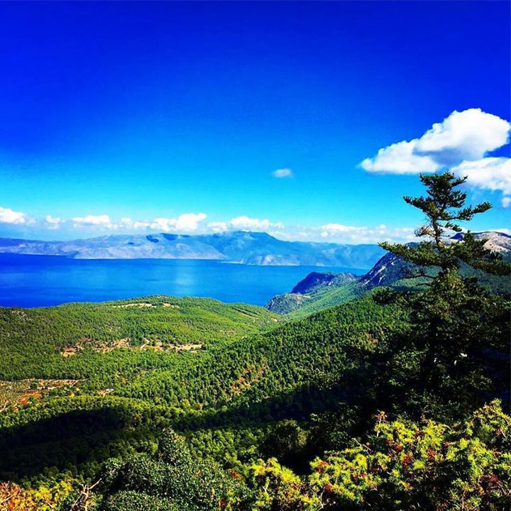
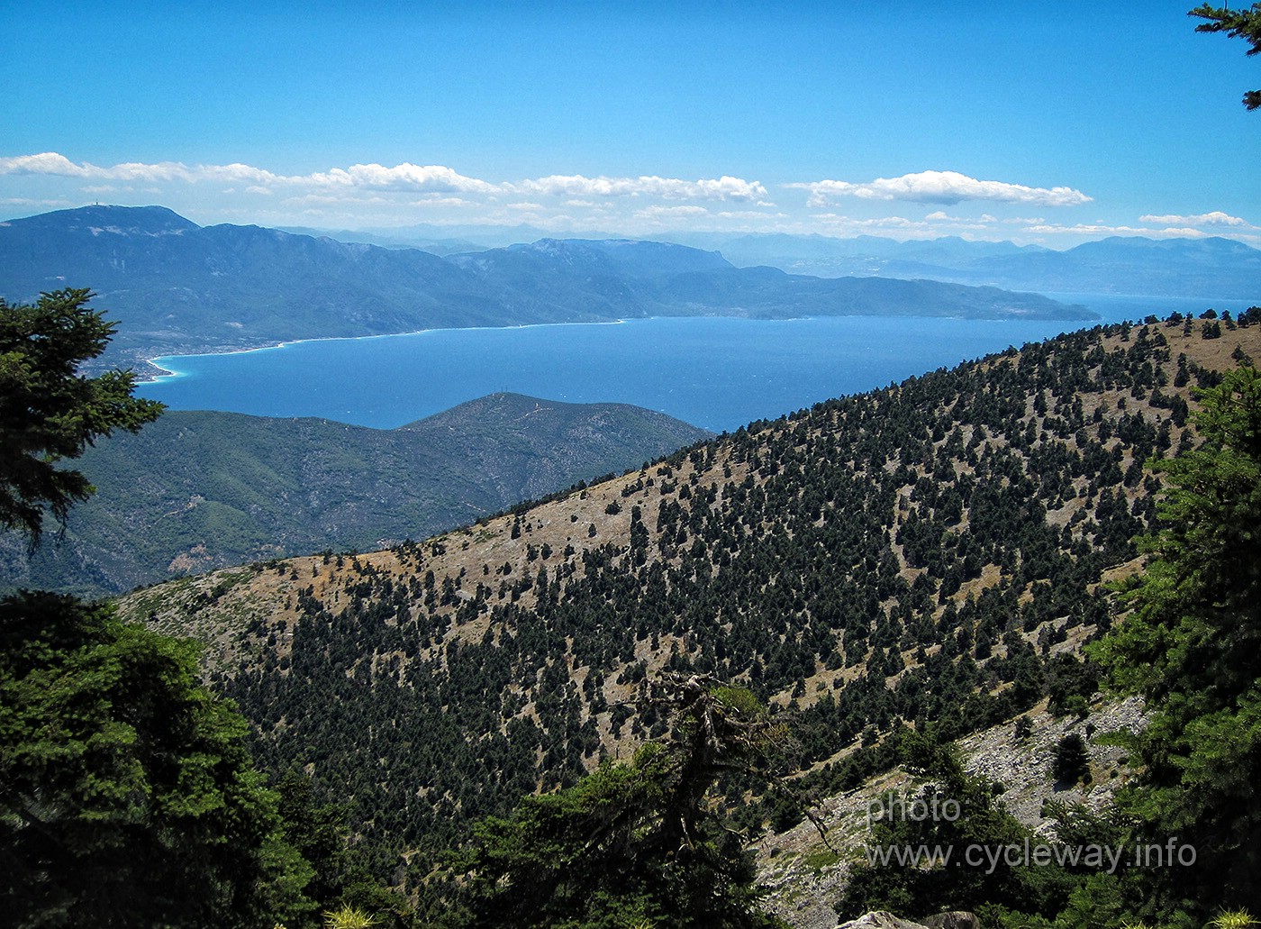
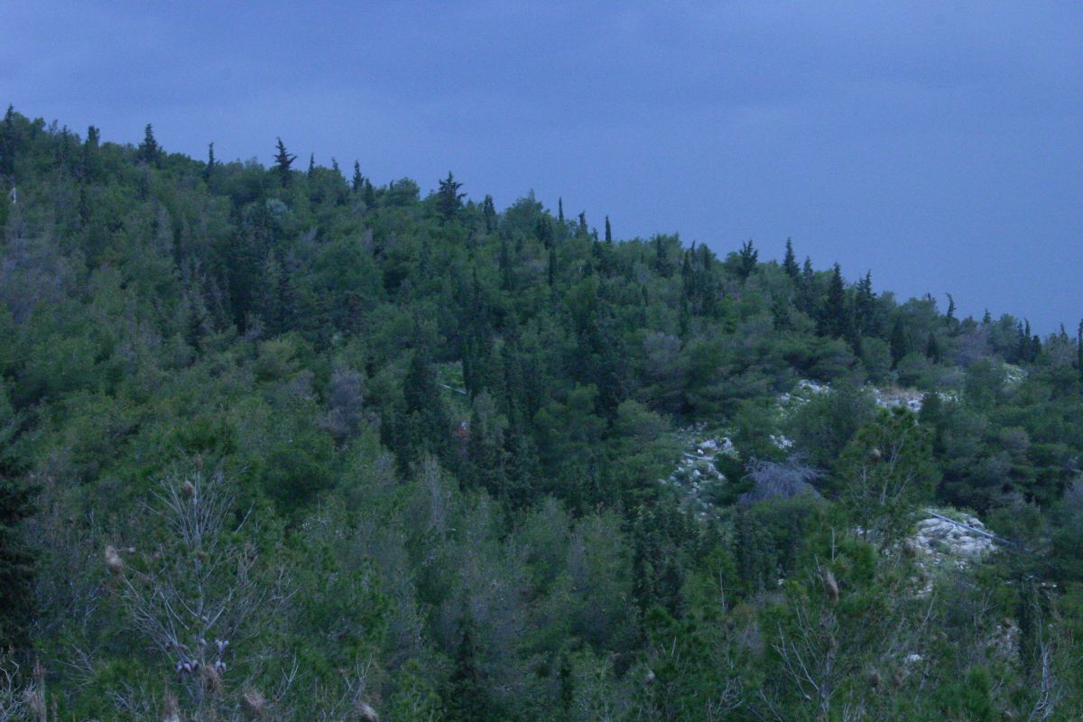
Mount Gerania
Geraneia, a mountain range with relatively steep slopes covered with pine and fir trees, stretches from Megara to Loutraki and Perachora, in the Prefecture of Corinth. In fact, it constitutes the natural boundary between Corinth and the Megarid. The southeastern end of Geraneia meets the Skironian Rocks, a site currently known as Kakia Skala. It is off this steep and dangerous coast that the Athenian hero Theseus toppled the notorious bandit Skiron.
Read more...
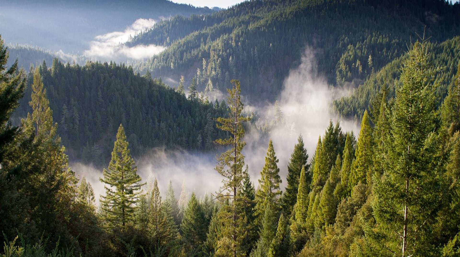
Mount Cithaeron
Covered by dense forests of pines and firs, Mount Cithaeron stretches to the northwest of Athens, along the border between Boeotia and the Megarid, and belongs to the mountain range connecting Parnes to Mount Parnassus. It begins to the west of Livadostros bay, runs along the coast of the Alkyonides gulf and,united with Mount Pastra, reaches the Skourtaplain, in the Dervenochoria region. Pastra, characterised by steep slopes and deep valleys, is to be found between Erythres and the town of Skourta. The mountainous massifs of Cithaeron and Pastra are separated by the Kaza passage, which is crossed by the old national road from Athens to Thebes. To the east of the road, just above Kaza, stand the impressive ruins of the Eleutheres fortress, also known as Gyftokastro.
Read more...
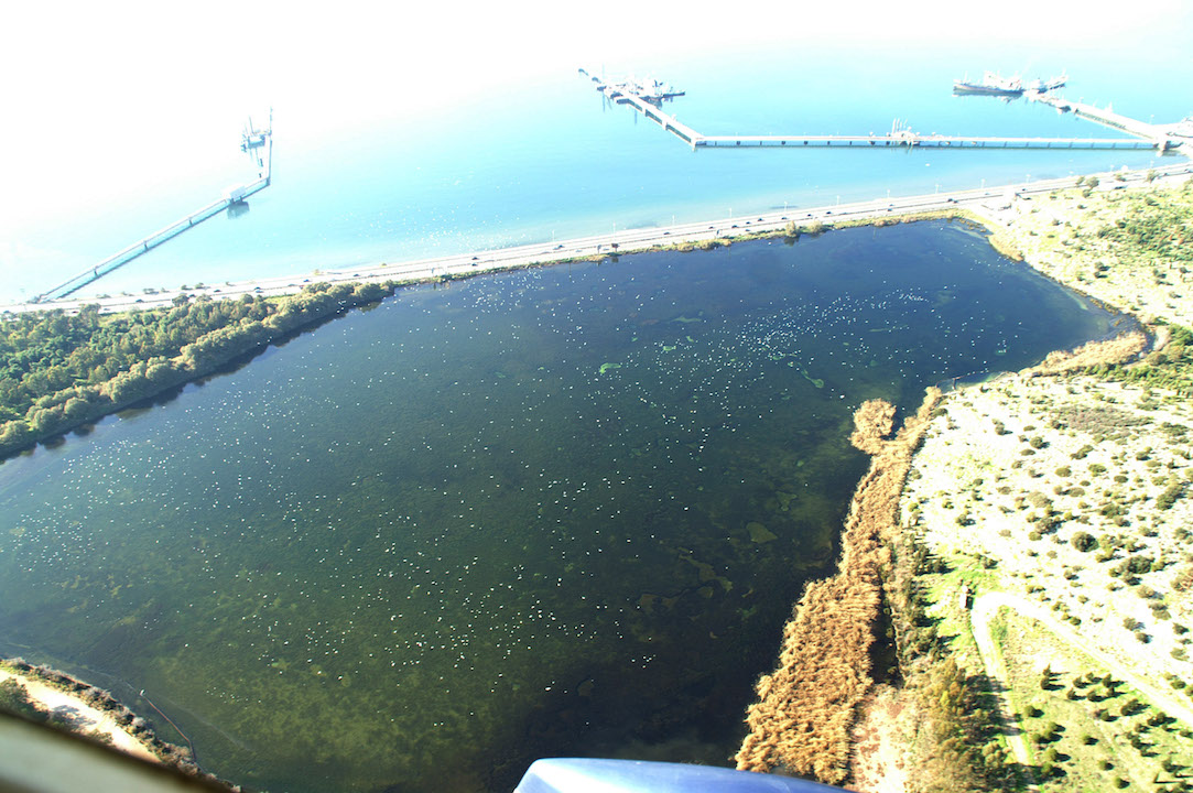
Reitoi ( lake Koumoundourou)
The modern lake Koumoundourou, in the southern region of the Municipality of Aspropyrgos, is identified with the site of the ancient twin ponds of Reitoi. The Reitoi were small artificial lakes created by the waters of a group of springs on the western foot of Mount Aigaleo, about 300 m north of the coast. The northern lake was devoted to Demeter, whereas the southern to Persephone. The latter has been preserved until the present day and is currently known as “lake Koumoundourou”. It marks the border between the modern towns of Haidari and Aspropyrgos. Similarly, in ancient times the Reitoi lakes constituted the boundary separating Athens and Eleusis. Old residents of the area have reported that during the 1950s both lakes existed; they had clear, perpetually changing waters with natural fish reserves. Theenlargement of the Athens-Corinth national road, which took place after World War II, reduced the surface of lake Koumoundourou significantly. The northern lake, known as “Kephalari”, was drained and filled with earth during the construction of the Aspropyrgos oil refinery in the 1950s.
Read more...
Mount Aigaleo
The mountain range of Aigaleo is one of the most prominent geographical features of the landscape to the west of Athens, separating the latter from the Eleusinian plain. It is, essentially, an extension of Parnes starting from Ano Liosia and running southwards to the Salamis strait. Mount Aigaleo, about 5 km wide and 20 km long, has never had adequate spring waters and, thus, its vegetation has been rather thin, mainly consisting of pine trees. Aigaleo features two peaks, as it consists of two large mountainous massifs connected by means of a narrow neck; the latter was crossed by the Sacred Way, in the vicinity of the famous Dafni monastery. The range’s eastern section, i.e. that from Dafni to Liosia and Dema, was known in antiquity as “Corydallus”; the western part of the mountain range, namely the section from Dafni to the Scaramangas coast, was called “Aigaleos”. Aigaleo is generally considered as the place chosen by the Persian king Xerxes to watch the sea battle of Salamis.
Read more...

Mount Pateras
Mount Pateras occupies the northwestern section of Western Attica. It features steep slopes and deep gorges covered with pine and fir trees, lentisks, and arbuti. On the northeastern slopes of Mount Pateras, near Palaiochori, a walled citadel with traces of habitation from the Geometric until the Roman period has been found; it has been identified by some researchers with that of ancient Ereneia.
Read more...
Mount Parnes
Parnes is an extensive, 30 km long mountain range with a maximum width of 20 km. It is located in the northwestern section of Attica. Mount Parnes’ highly rugged relief features steep slopes, spectacular gorges, valleys, and plateaus. There are also several caves, the most famous being Lychnospelia in Phyle, at an altitude of 675 m, where the goatfooted god Pan and the Nymphs were worshipped. In antiquity, Parnes accommodated several fortresses, as it constituted the natural boundary between the territory of Athens and that of its northwestern neighbours. Moreover, a major shrine dedicated to the cult of Zeus, as well as many ancient towns and villages have been identified across Parnes.
Read more...

Porto Germeno
Germeno Porto located in the southern extension of Mount Kitheronas the Corinthian Gulf, in antiquity was called Aigosthena and was an important trading port of Corinth. In Porto Germeno lies the fortified fortress of Aigosthena dating in 4 to 3. BC century.Today Germeno Porto is a resort just a short time from Athens and offers the unique combination of mountain and sea, with beautiful natural beaches and a stunning view with beautiful sunsets!In Germeno Porto you will find many restaurants where you can eat fresh, local fish, cafes, fast food of many species, lodgings, shops with food and seasonal items.Germeno Porto also has a port with chute for small boats.
Read more...

Psatha Beach
Psatha beach is located in West Attica, nearby Alepochori , in the crystal clear waters of the Corinthian gulf . It is a huge 2.5 km long coast, which would satisfy even the most demanding visitor. An ideal place of fun, suited not only for people of younger age, as there are plenty of café bars with organized offers and the beach itself. You will find a great a great variety of traditional Greek taverns , where you can enjoy fresh fish and a beautiful idyllic scenery which reminds more of some exotic destinations. An important aspect of Psatha is the vast habitat is has, in which grow the well known psathokalama from which the naming of the place originates. If you own a small boat Alepochori provides a small port with a chute.
Read more...
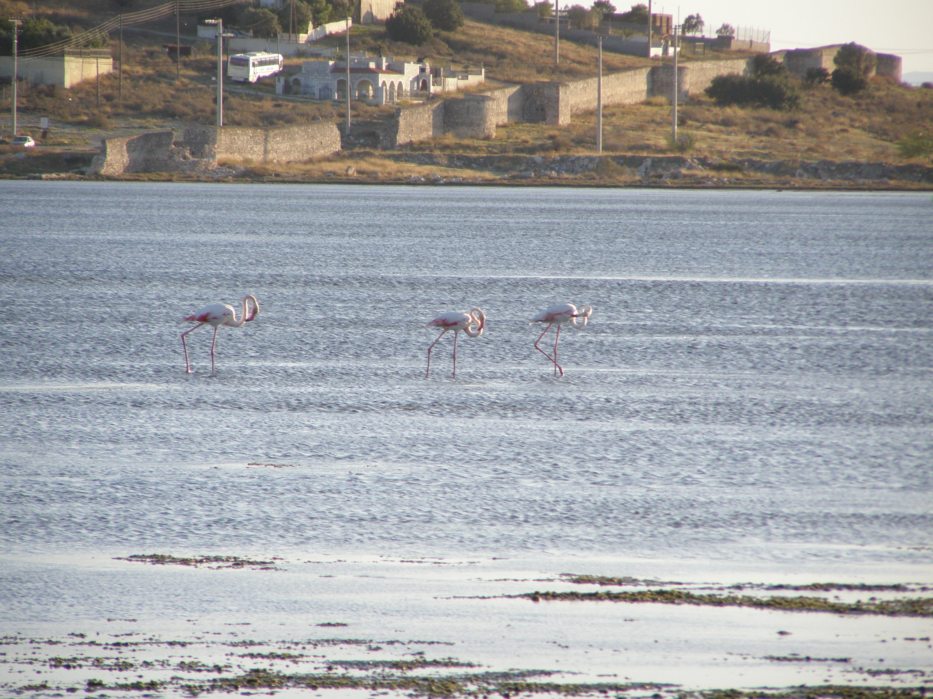
Voyrkari
Vourkari is located on the southeast coast of the municipality of Megara between New Peramos (formerly Great Pine) and Pachi Megara opposite Salamis. It is a coastal wetland fed mainly from sea and rain.The marine area is a shallow bay-lagoon with a depth of less than 1 meter at its greatest extent, which serves as an ideal natural fish farm. The terrestrial part is periodically covered by water and halophytic vegetation and formerly occupied an area of 5 square kilometers but today due to anthropogenic pressures has been limited to only 1 km².In Vourkari -particularly during the migration period- is recorded an extremely rich and important birdlife with more than 130 different species of birds (herons, flamingos, swans, mallards, cormorants etc.) several of which are rare and endangered both nationally and globally (Limoges, Eurasian curlew, red-footed falcon, sandwich, etc.).
The species for which the wetland of Megara surpasses the usual data of small wetlands of southern Greece -which each of them however remains unique and irreplaceable for the needs of the birds- and is now recognized as a wetland of international importance, is the Mediterranean gull.While it may seem incredible, Vourkari is the largest wetland in Greece and one of the most important for wintering of the kind worldwide as a key habitat that consistently reported large numbers corresponding to more than 1% of the world population of the species!After seven years of continuous, methodical, coordinated and multi-level action of the 'Coordinating Body for the protection of Vourkari (collective founded by local associations of the wider region) and its cooperation with agencies and organizations from all over Greece, the wetland of Megara is just one step from being classified as a 'Regional Park' -as the State Council has already approved the elaborated by the Ministry of Environment Draft Presidential Decree on the protection of it- by joining in this way a permanent and strong legal protection status determination protected areas, land use, building restrictions and the management measures.Trying all now turning to rehabilitation and outreach activities of the wetland such as creating bird observatories and environmental education center, placing information signs, removal of debris, restoration of wetlands tangent to the historic 'Wall Megara' etc.
Read more...
The species for which the wetland of Megara surpasses the usual data of small wetlands of southern Greece -which each of them however remains unique and irreplaceable for the needs of the birds- and is now recognized as a wetland of international importance, is the Mediterranean gull.While it may seem incredible, Vourkari is the largest wetland in Greece and one of the most important for wintering of the kind worldwide as a key habitat that consistently reported large numbers corresponding to more than 1% of the world population of the species!After seven years of continuous, methodical, coordinated and multi-level action of the 'Coordinating Body for the protection of Vourkari (collective founded by local associations of the wider region) and its cooperation with agencies and organizations from all over Greece, the wetland of Megara is just one step from being classified as a 'Regional Park' -as the State Council has already approved the elaborated by the Ministry of Environment Draft Presidential Decree on the protection of it- by joining in this way a permanent and strong legal protection status determination protected areas, land use, building restrictions and the management measures.Trying all now turning to rehabilitation and outreach activities of the wetland such as creating bird observatories and environmental education center, placing information signs, removal of debris, restoration of wetlands tangent to the historic 'Wall Megara' etc.